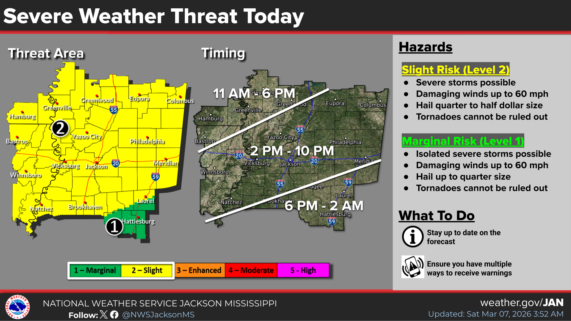
A severe thunderstorm watch has been issued for parts of Louisiana and Mississippi until 9 p.m. Saturday.
Mississippi counties included in the watch area issued by the National Weather Service include Adams, Attala, Carroll, Choctaw, Claiborne, Clarke, Clay, Copiah, Covington, Franklin, Grenada, Hinds, Holmes, Humphreys, Issaquena, Jasper, Jefferson, Jefferson Davis, Jones, Kemper, Lauderdale, Lawrence, Leake, Leflore, Lincoln, Lowndes, Madison, Montgomery, Neshoba, Newton, Noxubee, Oktibbeha, Rankin, Scott, Sharkey, Simpson, Smith, Warren, Webster, Winston and Yazoo.
"Severe thunderstorms capable of producing damaging wind gusts and large hail are possible today mainly during the afternoon and evening," the weather service said on its website. "Tornadoes cannot be ruled out. The storm threat will generally shift from northwest to southeast from the daytime into the night.
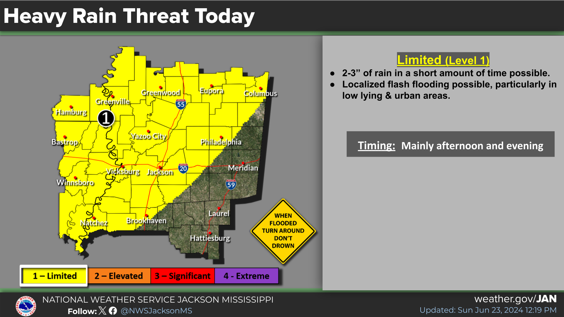
"A localized flash flood threat may develop today over the northwest two thirds of the area where 2 to 3 inches of rainfall in a short amount of time is possible."
 Courtesy of the National Weather Service
 Courtesy of the National Weather Service